


Beaverton-City Hall, Lamar County, Alabama
About
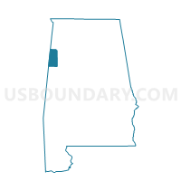
Outline

Summary
| Unique Area Identifier | 522197 |
| Name | Beaverton-City Hall |
| County | Lamar County |
| State | Alabama |
| Area (square miles) | 14.49 |
| Land Area (square miles) | 14.49 |
| Water Area (square miles) | 0.00 |
| % of Land Area | 100.00 |
| % of Water Area | 0.00 |
| Latitude of the Internal Point | 33.96836310 |
| Longtitude of the Internal Point | -88.00025840 |
Maps

Graphs
Select a template below for downloading or customizing gragh for Beaverton-City Hall, Lamar County, Alabama


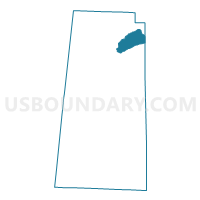
Neighbors
Neighoring Voting District (by Name) Neighboring Voting District on the Map
- Beaverton South City Hall, Lamar County, AL
- City Hall-Guin, Marion County, AL
- Crews-Goode-Methodist Church, Lamar County, AL
- Henson Springs-Fire Station, Lamar County, AL